Your Guide to Navigating Pakistan’s Hidden Gems
Introduction: Rediscovering the Art of Navigation
In the era of digital convenience and GPS, traveling with a paper map may seem like an outdated skill. However, exploring the untouched beauty of Pakistan with a paper map offers a unique and immersive experience. It allows you to disconnect from technology, connect more deeply with your surroundings, and discover hidden gems that may not be marked on digital maps.
For those who are ready to embrace a traditional yet adventurous way of exploring Pakistan’s scenic landscapes, ancient cities, and remote areas, here’s your complete guide on how to travel with a paper map.
Why Travel with a Paper Map?
Traveling with a paper map adds an element of old-school adventure and charm to your journey. Here’s why it’s a great idea:
- Embrace Authentic Exploration: Relying on a paper map forces you to interact with locals and pay close attention to your surroundings, making the experience more engaging.
- No Need for Connectivity: Many remote regions in Pakistan, such as Fairy Meadows, Deosai National Park, or parts of Balochistan, have little to no cellular service. A paper map ensures you’re never left without direction.
- Discover Hidden Paths: Some lesser-known trails, ancient ruins, and off-the-beaten-path destinations may not be marked on digital maps, but older paper maps can reveal these treasures.
Step 1: Choosing the Right Paper Map for Your Journey
Not all paper maps are created equal. Choosing the right type of map for your journey is crucial, especially if you’re exploring remote regions in Pakistan. Here are a few things to consider:
- Topographical Maps: These maps are ideal for trekking in areas like Kaghan Valley or Skardu. They show elevation, terrain features, and can help you understand the lay of the land.
- Road Maps: If you’re traveling by car, especially on adventurous road trips like the Karakoram Highway or through Balochistan’s coastal route, a road map will help you navigate the highways and smaller routes.
- Tourist Maps: Cities like Lahore and Islamabad offer tourist maps that highlight historical sites, cultural landmarks, and places of interest.
Step 2: Understanding Key Map Symbols and Legends
To effectively use a paper map, it’s essential to familiarize yourself with its symbols and legends. Here’s what you need to pay attention to:
- Contour Lines: These lines indicate elevation. When contour lines are close together, it means the terrain is steep. Spread out lines indicate flat or gentle slopes.
- Scale: The map’s scale will tell you how distances on the map correspond to real-world distances. For instance, 1:50,000 means 1 cm on the map represents 500 meters on the ground.
- Compass Rose: The compass rose or direction indicator helps you determine north, south, east, and west on the map.
- Symbols: Study the symbols and their meanings, such as trails, rivers, roads, ruins, and elevation points.
Step 3: Plotting Your Route and Marking Key Points
Before setting out on your adventure, plot your route on the map and mark key points of interest. For instance:
- Highlight the Starting Point and Destination: Clearly mark your starting point and destination, and note any landmarks in between.
- Identify Water Sources and Rest Points: If you’re trekking in areas like Chitral or Swat Valley, marking water sources and potential rest spots is essential.
- Mark Potential Hazards: In regions like Fairy Meadows, known for its breathtaking views but challenging terrain, it’s crucial to mark potential hazards like rivers or steep sections.
Step 4: Mastering the Compass and Map Together
A paper map and compass go hand in hand. If you want to navigate accurately, you’ll need to know how to use them together:
- Orient the Map: Place your map flat and use your compass to align it with magnetic north. This helps you understand the direction you’re facing.
- Set the Bearing: Identify your destination on the map and use the compass to set a bearing. Walk in the direction indicated by the compass needle while keeping your eye on landmarks marked on the map.
- Check Your Progress: Regularly refer to your map and compass to ensure you’re on the right track, especially when hiking or driving in unfamiliar terrain.
Step 5: Navigating the Unmarked Trails
One of the most exciting aspects of traveling with a paper map is discovering unmarked trails. Pakistan is home to many hidden paths, scenic routes, and ancient tracks that are not documented on digital maps. Here’s how to find and navigate these:
- Talk to the Locals: Locals are often the best source of information about hidden trails. For instance, if you’re in Gilgit-Baltistan, ask the residents about lesser-known trekking routes.
- Rely on Landmarks: Use landmarks such as mountains, rivers, and bridges to orient yourself. Pakistan’s diverse geography provides many natural landmarks that can help guide your way.
- Stay Open to Discovery: Embrace the possibility of getting slightly off-track. It’s part of the adventure and often leads to discovering beautiful, unexpected places.
Step 6: Staying Safe While Traveling with a Paper Map
Traveling with a paper map requires a bit more vigilance, especially in remote areas. Here are some safety tips:
- Carry Backup Maps: Always have a backup map in case the primary one gets wet or torn. Laminated or waterproof maps are ideal for regions with unpredictable weather, like Kaghan Valley or Neelum Valley.
- Don’t Rely Solely on Memory: It’s tempting to put the map away after glancing at it, but always double-check your location periodically.
- Prepare for Emergencies: In remote areas like Balochistan or Khyber Pakhtunkhwa, carry basic survival gear like a first-aid kit, extra food, and warm clothing.
Advantages of Exploring Pakistan with a Paper Map
Traveling with a paper map in Pakistan offers unique advantages:
- Better Cultural Engagement: Paper maps often spark conversations with locals who offer valuable insights and stories about the area.
- Slower, More Immersive Travel: With a paper map, you’re more likely to notice your surroundings, immerse yourself in the environment, and savor the journey instead of rushing from one point to another.
- Disconnection from Digital Distractions: Using a paper map allows you to disconnect from screens and enjoy the raw beauty of Pakistan’s diverse landscapes.
Best Destinations in Pakistan to Explore with a Paper Map
If you’re ready to embrace the adventure of traveling with a paper map, here are some destinations in Pakistan that offer the perfect combination of natural beauty and exploration opportunities:
- Naltar Valley: Known for its lush green meadows, lakes, and skiing opportunities, Naltar is ideal for those seeking remote and scenic destinations.
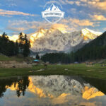
- Fairy Meadows and Nanga Parbat Base Camp: These are perfect for trekkers and nature lovers who want to navigate the terrain while being immersed in breathtaking views.
- Kalash Valley: If you’re interested in cultural adventures, Kalash offers a unique opportunity to explore ancient traditions and beautiful landscapes.
Conclusion: Embrace the Journey with a Paper Map
In a world dominated by digital devices, traveling with a paper map allows you to experience the essence of adventure. Whether you’re exploring the towering peaks of the north, the rich culture of the cities, or the mysteries of the deserts, a paper map can guide you to new experiences and hidden gems.
At Pakistan Packages Tour, we encourage you to embrace the old-school charm of paper maps, interact with locals, and take in the beauty of the journey. Adventure awaits those willing to slow down, explore thoughtfully, and discover the magic that lies beyond the digital world.
So, grab your paper map, set your compass, and get ready to navigate the extraordinary beauty of Pakistan. Happy travels!
